
Manage government estates more efficiently with data-informed decisions

Reliable data for
common scenarios
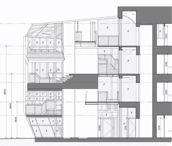
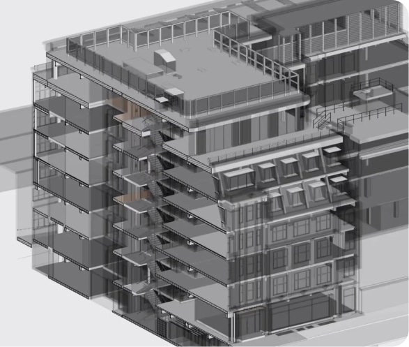
- Faster design, space planning and approval process with BIM-ready 3D Revit® models, enabling collaboration across internal and external teams, and support regulatory compliance
- Optimised equipment installation, including obtaining faster, more accurate estimates and efficient planning for repairs
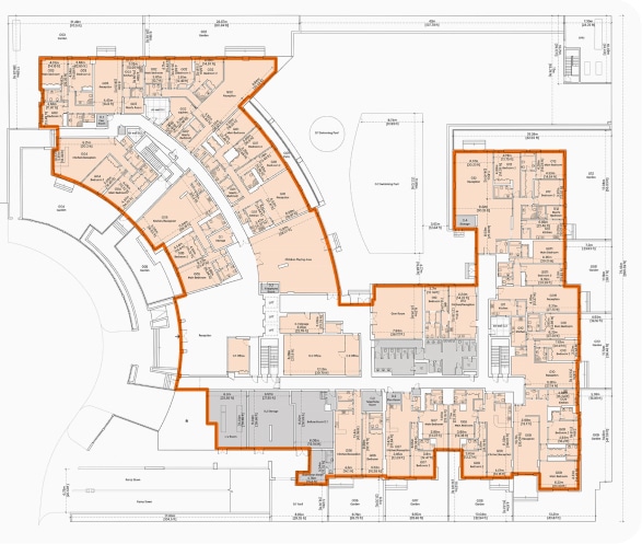
- Verified schedule of areas reporting, compliant with international and local measurement standards, critical for lease management, including lease administration and accounting
- Use dimensional data and 3D models to document above ground utilities, mechanical, electrical and plumbing (MEP) equipment and furniture, fixtures and equipment (FF&E)
- Replace time-consuming, inaccurate and uninsured manual measurements with guaranteed accurate and compliant Measured Building Survey measurements
- Improve public and employee safety with virtual tours, compliant building plans and interactive 3D models
- Increase situational awareness for employees and first responders in case of an emergency
- Stak delivers fire safety compliant floor plans, that support in planning emergency routes and response strategies
- Train employees and provide superior visibility to first responders in the case of emergency
- DRC’s digital twins enables facilities managers and engineers to determine the most suitable and compliant location of critical equipment
- Easily distribute an accurate 3D model and virtual tour of your facilities with new or visiting employees, so they can quickly understand your space
- Easy to use, intuitive and interactive online platform that all required team members can use
- Educate new employees on complex facilities, especially in hard to reach or potentially dangerous areas, resulting in reduced human error and more consistent operational processes
- Replace time-consuming, inaccurate and uninsured manual measurements with guaranteed accurate and compliant Stak Verified® measurements
- Offer remote, virtual access to historic landmarks and other prominent sites of high-interest
- Improve continuity of operations during adverse weather conditions or other disruptions
- Ensure and expand accessibility to visitors
- Offer remote, virtual access to historic landmarks and other prominent sites of high-interest
- Improve continuity of operations during adverse weather conditions or other disruptions
- Ensure and expand accessibility to visitors
Why it matters
Confidence
in compliance
Better planning
for public services
Clear insight for
long-term stewardship
View an example project
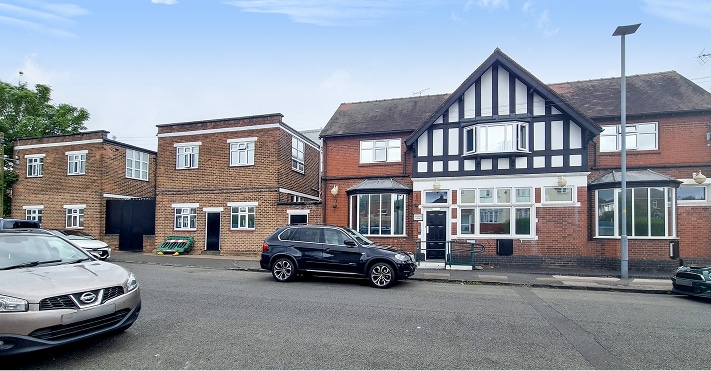
Ministry of Justice, UK


REQUIREMENTS AND DELIVERABLES.
- Our ability to work at such a rapid pace and coordinate all project management and logistics without compromising on quality was a key differentiator for the Ministry of Justice, who required reliable data to support their operations
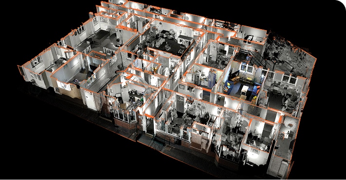
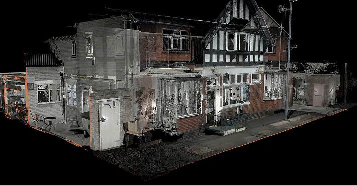
- Measured Building Survey verified floor plans, including schedule of areas, professional photography and digital brochure page
- Scan-to-CAD with client specific inclusions
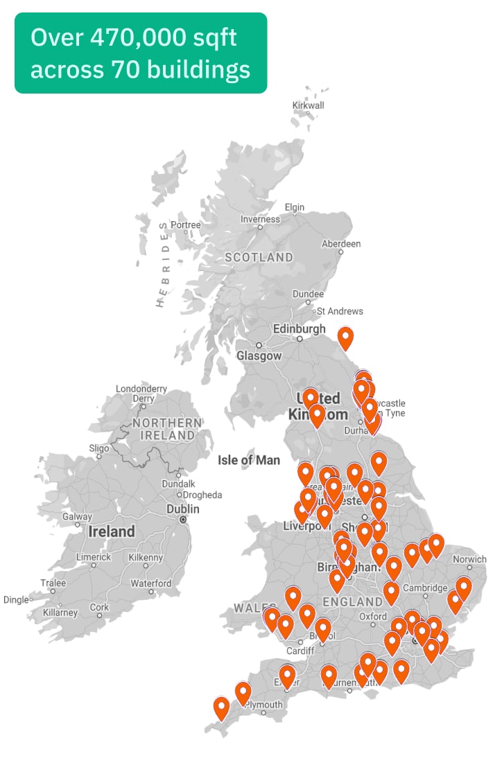
- Location: 70 buildings across the UK
- Area: Over 470,000 sqft
- Asset class: Commercial
- Purpose: Procurement of FM contract
Explore the services we provide
Measured Building Survey
Delivering accuracy you can trust, we create a single verified dataset that helps you understand and showcase your property with confidence.
Scan-to-CAD
We transform 3D scans into detailed 2D CAD drawings, delivering accurate floor plans, sections, and elevations derived from verified point cloud data.
Scan-to-BIM
Using advanced laser scanning and BIM technology, we create high-accuracy 3D models with full architectural, structural, and MEP detail.
UAE Surveying Services
We are an approved third-party surveyor, specialising in off-plan (Oqood, as-planned) and completion (title deed, as-built) surveys.

Spatial-IQ
Turn your building data into dynamic, interactive insights. Spatial-IQ transforms static surveys into a connected, visual platform, helping you understand, manage, and unlock value across your entire property portfolio.
