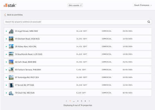
Services
Digital surveying services built around your project needs
Measured building survey
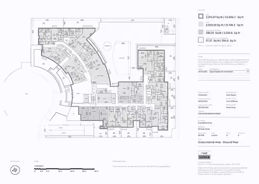

- Floor plans that adhere to the standards and regulations across the UK, UAE, USA and Singapore, including International Property Measurement Standards (IPMS) and BOMA
- Professional-grade photography
- Digital brochure page
- Virtual tour (optional)
- Data accessible via Stak Hub platform
Learn more
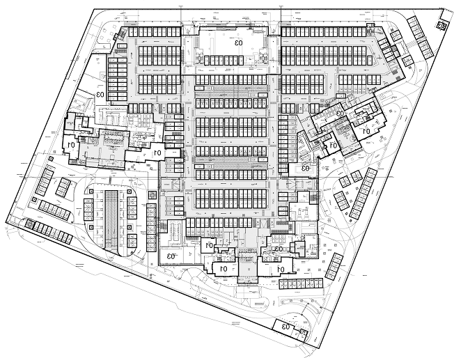
Scan-to-CAD
.avif)
- Accurate 2D CAD drawings generated from point cloud data
- Prepared to your specific requirements, from fire safety to space planning
- Example deliverables include CAD plans, sections, external & internal elevations, and reflected ceiling plans
- Conforms to architectural standards
Learn more
Scan-to-Revit
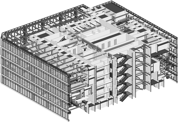
- Exact representation of as-built conditions for building information modelling (BIM)
- LOD100 to LOD300 available
- Conforms to architectural standards
Learn more
UAE Strata consultancy
- Documentation preparation for Oqood, Final, Ejari and Master Community registration
- Lease Outline Drawing (LOD's), marketing plans and SPA layouts for leasing and selling
- Verify registered areas in title deeds
- Surveys and plan preparation for GFA calculations
Learn more